+
.com
USD
  • Account
  • Sign Up
  • Sign In
You have no items in your shopping cart.
ABOUT 1OUTLETS
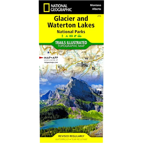
Home Shopping Other Glacier and Waterton Lakes National Parks Map (National Geographic Trails Illustrated Map, 215)
By National Geographic Maps - Trails Illustrated (Author) Glacier and Waterton Lakes National Parks Map (National Geographic Trails Illustrated Map, 215)

By National Geographic Maps - Trails Illustrated (Author) Glacier and Waterton Lakes National Parks Map (National Geographic Trails Illustrated Map, 215)

( 288 reviews ) See Reviews (1Outlets)

In stock *In Stock - Subject to stock availability at point of fulfilment. In the event whereby the item is out of stock or unable to provide the service, 1Outlets will cancel the order and issue a Full refund in-store credit to you. SKU : f796bb4792ed38bcfb7af0c66886c087

USD6.62
  • Buy 2 for USD6.03 each and save 10%
  • Buy 10 for USD5.67 each and save 17%
Qty:

**Free Shipping Worldwide available - Shipping time may vary depending on the address.

**Circumstances Reroute - This is a time of great stress and uncertainty. We are actively validating, routing and re-routing orders with our overseas merchants, logistic partners and airlines. Deliveries and supply may expect delays.

**In Stock (Low Inventory Warning) - Subject to stock availability at point of fulfilment. In the event whereby the item is out of stock or unable to provide the service, 1Outlets will cancel the order and issue a Full refund in-store credit to you (See Refunds).

**Report or Request Removal  - Any copyrighted, DMCA, inappropriate, offensive, prohibited, potentially Illegal Listings (Submit doc here).

Details

Explore the Untamed Beauty of Glacier and Waterton Lakes with National Geographic Trails Illustrated Maps!

Glacier and Waterton Lakes National Parks Map (National Geographic Trails Illustrated Map, 215) is your ultimate companion for unforgettable adventures in these stunning national parks. This detailed and easy-to-use map showcases every breathtaking trail, pristine lake, and majestic peak, ensuring you never lose your way while exploring the incredible landscapes. Plan your perfect hike, discover hidden gems, and create memories that will last a lifetime with the unparalleled accuracy and clarity of this essential National Geographic Trails Illustrated Map.

Main Features

  • Detailed Trail Network: Every trail is meticulously mapped, including difficulty levels and distances.
  • Topographic Accuracy: Experience precise elevation changes for optimal route planning.
  • Water Features: Crystal-clear lakes, rushing rivers, and cascading waterfalls are beautifully depicted.
  • Points of Interest: Discover scenic overlooks, historical sites, and wildlife viewing areas.
  • Durable, Waterproof Material: Built to withstand the elements, ensuring your map remains reliable in any condition.

Benefits

  • Effortless Navigation: Confidently explore these vast parks without getting lost.
  • Enhanced Safety: Know your location and plan your routes with precision.
  • Unforgettable Experiences: Discover hidden gems and fully immerse yourself in nature's wonder.
  • Comprehensive Planning: Prepare your hikes with detailed information and accurate distances.
  • Durable & Reliable: Enjoy peace of mind knowing your map will last throughout your adventures.

Unique Selling Points / Competitive Advantages

  • National Geographic Authority: Benefit from the reputation of a trusted and respected brand.
  • Exceptional Detail: Experience unparalleled accuracy in trail markings and geographical features.
  • User-Friendly Design: Navigate with ease thanks to intuitive map layout and clear legend.
  • Comprehensive Coverage: Explore the entire expanse of both Glacier and Waterton Lakes National Parks.
  • Waterproof & Tear-Resistant: Withstand any weather conditions and remain reliable for multiple adventures.

Usage Scenarios

  • Backpacking Trips: Plan multi-day treks with confidence, knowing your route is accurately represented.
  • Day Hiking: Find the perfect trail that matches your skill level and desired length.
  • Family Adventures: Explore nature together with peace of mind and accurate navigation.
  • Wildlife Viewing: Locate prime wildlife viewing areas and plan accordingly.
  • Photography Expeditions: Discover breathtaking viewpoints and capture stunning panoramic shots.

Customer Reviews / Testimonials

  • "This map was invaluable during our recent backpacking trip to Glacier National Park. It was easy to follow and incredibly accurate!" - John S., Canada, 2022
  • "A must-have for anyone exploring Waterton Lakes. The detail is amazing, and it helped us find some hidden gems." - Maria R., United Kingdom, 2023
  • "I've used many hiking maps, but this one is the best. The clarity and durability are superior. Highly recommend!" - David L., Australia, 2021
  • "Perfect for planning family hikes. It's easy for kids to understand and use." - Sarah M., United States, 2024
  • "This map made our trip to both parks so much more enjoyable. We felt safe and confident knowing where we were at all times." - Thomas B., New Zealand, 2023

Frequently Asked Questions (with answers)

  • Q: Is this map suitable for beginners? A: Yes, its clear design and detailed legend make it user-friendly for all skill levels.
  • Q: Does it show elevation changes? A: Yes, the topographic map clearly illustrates elevation for optimal route planning.
  • Q: Is the map waterproof? A: Yes, the map is made from durable, waterproof material.
  • Q: Does it cover all of both parks? A: Yes, the map provides comprehensive coverage of both Glacier and Waterton Lakes National Parks.
  • Q: What scale is the map printed on? A: The map's precise scale allows for accurate navigation and planning.

BUY NOW and discover the adventure with National Geographic Trails Illustrated Maps – your trusted guide to unforgettable explorations in nature’s most captivating landscapes!

(Beta: User Generated 2024.0007)
Specification
Terms & Warning