+
.com
USD
  • Account
  • Sign Up
  • Sign In
You have no items in your shopping cart.
ABOUT 1OUTLETS
Home Shopping Other Navionics Plus Regions South Marine and Lake Charts on SD/MSD
Navionics Plus Regions South Marine and Lake Charts on SD/MSD

Navionics Plus Regions South Marine and Lake Charts on SD/MSD

Brand

Navionics

( 180 reviews ) See Reviews (1Outlets)

In stock *In Stock - Subject to stock availability at point of fulfilment. In the event whereby the item is out of stock or unable to provide the service, 1Outlets will cancel the order and issue a Full refund in-store credit to you. SKU : 9925aa98c88eeade3422c35f67be01c2

Qty:

**Free Shipping Worldwide available - Shipping time may vary depending on the address.

**Circumstances Reroute - This is a time of great stress and uncertainty. We are actively validating, routing and re-routing orders with our overseas merchants, logistic partners and airlines. Deliveries and supply may expect delays.

**In Stock (Low Inventory Warning) - Subject to stock availability at point of fulfilment. In the event whereby the item is out of stock or unable to provide the service, 1Outlets will cancel the order and issue a Full refund in-store credit to you (See Refunds).

**Report or Request Removal  - Any copyrighted, DMCA, inappropriate, offensive, prohibited, potentially Illegal Listings (Submit doc here).

Details

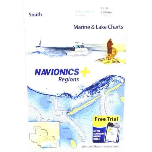
Navionics Navionics Platinum+ Navionics Plus Regions South Marine and Lake Charts on SD/MSD

Navigate with Navionics, Explore with Joy!

The Navionics Platinum+ brings the wonders of the waters right to your fingertips! This marvel of marine technology empowers young adventurers to explore, discover, and chart their courses on the seas and lakes. Imagine vibrant, detailed charts that leap to life, guiding you on epic voyages across the South Marine and Lake regions. Navigate with confidence and create unforgettable experiences with Navionics.

Main Features

  • Detailed Charts: Discover underwater worlds with intricate depth contours, making it a breeze to visualize the ocean floor and hidden treasures. Imagine seeing every nook and cranny of the aquatic world!
  • Satellite Overlay: Picture the waters with the ability to see aerial views and gain a new perspective on your location. View your course with a bird's eye view.
  • 3D View: Delve deep into the seas and lakes with three-dimensional representations of the underwater terrain. Visualize the depths beneath you.
  • Community Edits: Experience the power of collaborative mapping, where fellow explorers share their knowledge and discoveries. Get updated insights from other sailors.
  • SonarChart Live: Observe real-time bathymetric maps, allowing you to trace the uncharted waters. See new maps appear before your eyes as you sail the lake and ocean.

Benefits

  • Enhanced Navigation: Enjoy safer and more informed travels, avoiding hidden dangers and charting the perfect paths. Make every voyage smooth and safe.
  • Increased Exploration: Open the doors to adventure with an easy access of uncharted territories and new fishing spots. Find all the best hidden locations.
  • Improved Safety: Make well-informed decisions and steer away from hazardous situations. Ensure safe journeys every time.
  • Unforgettable Experiences: Create memories that will last a lifetime, filled with fun, exploration, and discovery. Make lasting memories for your children and family.
  • Simplified Planning: Plan your adventures with the tools and information you need. Organize every excursion effortlessly.

Unique Selling Points / Competitive Advantages

  • Vivid Detail: Witness unparalleled clarity, revealing underwater landscapes and coastal features with unbelievable precision. See the unseen!
  • Real-time Updates: Experience live data that keeps you at the forefront of the latest nautical information. Stay ahead of the game with the most current data.
  • User-Friendly Interface: Master the waters quickly with intuitive and easy-to-use software. Navigate like a pro with the simple interface.
  • Extensive Coverage: Explore expansive regions, revealing the world's most desired waterways. Discover the vastness of the seas and lakes!
  • Superior Accuracy: Put your trust in the highest standards of data, confirming precise navigation and informed choices. Sail with the accuracy and confidence.

Usage Scenarios

  • Family Boating Trips: Transform family outings into grand adventures, offering an enjoyable and educational experience. Share fun and educational adventures with your loved ones.
  • Fishing Expeditions: Spot the best fishing spots, improve your catch, and find those prized catches. Discover the hidden locations where fish hide.
  • Kayaking and Canoeing: Enhance your water travels, helping you uncover peaceful waterways and admire breathtaking scenery. Explore hidden coves and peaceful waters.
  • Sailing Adventures: Enhance your sailing experiences, allowing you to chart new courses and discover fresh horizons. Seek out new harbors and ports.
  • Coastal Cruises: Chart the coastlines, uncovering hidden bays and iconic landmarks. Discover the beautiful coastlines and its secrets.

Customer Reviews / Testimonials

  • Carlos, Brazil, 2022: "My kids love it! The charts are so clear, and we're finding new spots every time. It's like having a treasure map, but real!"
  • Sophie, France, 2021: "We've been using this with our family during the summer vacation and it changed our experience. It’s so easy to use, even for my youngest daughter."
  • Kenji, Japan, 2023: "The 3D view is incredible. My son and I now spend hours planning our next adventures. We cannot stop admiring the clarity."
  • Maria, Italy, 2022: “We've found so many new locations that we could not have found with our previous navigation systems. I strongly recommend this product.”
  • Liam, Australia, 2024: “The Satellite view is the best for my fishing trips. I can easily see where to find the fish.”

Frequently Asked Questions

  • Is it easy to set up and use? Yes, the Navionics Platinum+ is designed with a user-friendly interface that's easy for all ages.
  • Are the charts regularly updated? Yes, the charts are frequently updated with the newest nautical data.
  • Does it work in all regions? The product offers a specific region – South Marine and Lake regions for SD/MSD cards.
  • Is it suitable for children? Absolutely! The platform is designed to be child-friendly, offering an educational and enjoyable experience.
  • What type of device do I need to use it? You'll need a compatible chartplotter or device that supports SD/MSD cards.

BUY NOW

With Navionics, embark on a journey where maps are brought to life, and the open waters become playgrounds for the young and the adventurous! Discover the treasures of the seas and lakes today with Navionics!

(Beta: User Generated 2024.0007)
Specification
Category: Other
Brand:

Navionics

Weight: 0.004535923696kgs
Height: 2.54cm
Length: 2.54cm
Item model number: 010-C1369-30
Manufacturer Part Number: 010-C1369-30
Terms & Warning