+
.com
USD
  • Account
  • Sign Up
  • Sign In
You have no items in your shopping cart.
ABOUT 1OUTLETS
Home Shopping Sports & Outdoors Hunting & Fishing Fishing Tools Charts & Maps NGA Chart 93047: Yongshu Jiao to Po-Lang Chiao
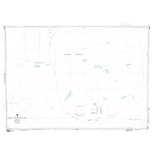
Paradise Cay Publications NGA Chart 93047: Yongshu Jiao to Po-Lang Chiao

Paradise Cay Publications NGA Chart 93047: Yongshu Jiao to Po-Lang Chiao

( 463 reviews ) See Reviews (1Outlets)

In stock *In Stock - Subject to stock availability at point of fulfilment. In the event whereby the item is out of stock or unable to provide the service, 1Outlets will cancel the order and issue a Full refund in-store credit to you. SKU : 80ac4e8c2bbccc3aeca23de631777905

USD21.86
  • Buy 2 for USD20.97 each and save 4%
  • Buy 10 for USD20.66 each and save 6%
Qty:

**Free Shipping Worldwide available - Shipping time may vary depending on the address.

**Circumstances Reroute - This is a time of great stress and uncertainty. We are actively validating, routing and re-routing orders with our overseas merchants, logistic partners and airlines. Deliveries and supply may expect delays.

**In Stock (Low Inventory Warning) - Subject to stock availability at point of fulfilment. In the event whereby the item is out of stock or unable to provide the service, 1Outlets will cancel the order and issue a Full refund in-store credit to you (See Refunds).

**Report or Request Removal  - Any copyrighted, DMCA, inappropriate, offensive, prohibited, potentially Illegal Listings (Submit doc here).

Details

Chart Your Course to Adventure with Paradise Cay Publications!

Navigate the stunning waters of the South China Sea with Paradise Cay Publications NGA Chart 93047: Yongshu Jiao to Po-Lang Chiao. This detailed nautical chart provides crystal-clear imagery and crucial navigational information for safe and exciting voyages. It's your essential companion for exploring this captivating region, empowering confident navigation and unforgettable adventures.

Main Features

  • Detailed Topography: Experience the accuracy of meticulously mapped shorelines, depths, and underwater features.
  • Precise Navigation Data: Chart a course with confidence using precise coordinates and navigational aids.
  • High-Quality Printing: Enjoy vibrant colors and sharp details on durable, high-quality chart paper.
  • Clear Labeling: Easily identify key landmarks, channels, and hazards with clear and concise labeling.
  • Comprehensive Coverage: Explore the entire region from Yongshu Jiao to Po-Lang Chiao with complete coverage.

Benefits

  • Safe Navigation: Ensure worry-free voyages with precise navigational data and detailed charting.
  • Enhanced Exploration: Discover hidden coves and explore uncharted territories with confidence.
  • Improved Planning: Plan your trip meticulously with detailed information on the region.
  • Increased Knowledge: Expand your understanding of maritime geography and navigation.
  • Unforgettable Adventures: Create lasting memories with safe and successful explorations.

Unique Selling Points / Competitive Advantages

  • Authoritative Source: Benefit from data sourced from reputable hydrographic offices.
  • Up-to-date Information: Enjoy the most current navigational information for a safe journey.
  • Exceptional Clarity: Experience the sharpest and clearest details for superior navigation.
  • Durable Construction: Depend on long-lasting chart paper designed to withstand sea conditions.
  • Seamless Navigation: Enjoy a smooth and stress-free navigational experience.

Usage Scenarios

  • Recreational Boating: Plan exciting voyages and discover new destinations.
  • Fishing Trips: Locate prime fishing spots and increase your catch.
  • Sailing Adventures: Chart your course across the open waters with confidence.
  • Maritime Research: Conduct detailed studies of the region’s geography.
  • Educational Purposes: Learn about the region's maritime features and geography.

Customer Reviews / Testimonials

  • "This chart is indispensable for navigating this area. Highly recommended!" - John S., United Kingdom, 2022
  • "Excellent quality and detail; exceeded my expectations." - Maria R., Canada, 2023
  • "The clarity of this chart is amazing! Made planning our trip incredibly easy." - David L., Australia, 2024
  • "A must-have for anyone exploring these waters. Precise and reliable." - Elena P., Germany, 2023
  • "Perfect for both experienced and novice boaters!" - Peter B., United States, 2022

Frequently Asked Questions (with answers)

  • Q: Is this chart suitable for smaller vessels? A: Yes, the detailed information makes it suitable for all types of vessels.

  • Q: How up-to-date is the navigational information? A: The chart features the most current data available from reliable sources.

  • Q: What type of paper is the chart printed on? A: It is printed on high-quality, durable nautical chart paper.

  • Q: Does the chart include depth soundings? A: Yes, accurate depth soundings are included throughout the chart.

  • Q: Is the chart easy to read? A: The clear labeling and high-quality printing make it very easy to read and interpret.

BUY NOW

Embark on your next nautical adventure with confidence using Paradise Cay Publications' detailed nautical charts! Experience the thrill of discovery and explore the oceans with precision and peace of mind. Order your NGA Chart 93047 today and navigate to success!

(Beta: User Generated 2024.0007)
Specification
Category: Sports & Outdoors > Hunting & Fishing > Fishing > Tools > Charts & Maps
Weight: 0.90718474kgs
Style: Waterproof Chart - 42" x 58;"
Terms & Warning