+
.com
USD
  • Account
  • Sign Up
  • Sign In
You have no items in your shopping cart.
ABOUT 1OUTLETS
Home Shopping Other Rand McNally State Maps: Kentucky and Tennessee (2 Maps)
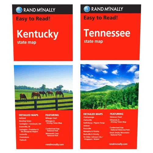
Rand McNally State Maps: Kentucky and Tennessee (2 Maps)

Rand McNally State Maps: Kentucky and Tennessee (2 Maps)

( 391 reviews ) See Reviews (1Outlets)

In stock *In Stock - Subject to stock availability at point of fulfilment. In the event whereby the item is out of stock or unable to provide the service, 1Outlets will cancel the order and issue a Full refund in-store credit to you. SKU : e262806238e5b310eb7def9884dd2405

Qty:

**Free Shipping Worldwide available - Shipping time may vary depending on the address.

**Circumstances Reroute - This is a time of great stress and uncertainty. We are actively validating, routing and re-routing orders with our overseas merchants, logistic partners and airlines. Deliveries and supply may expect delays.

**In Stock (Low Inventory Warning) - Subject to stock availability at point of fulfilment. In the event whereby the item is out of stock or unable to provide the service, 1Outlets will cancel the order and issue a Full refund in-store credit to you (See Refunds).

**Report or Request Removal  - Any copyrighted, DMCA, inappropriate, offensive, prohibited, potentially Illegal Listings (Submit doc here).

Details

Explore the Bluegrass and Volunteer States with Rand McNally!

Discover the captivating landscapes of Kentucky and Tennessee with Rand McNally State Maps: Kentucky and Tennessee (2 Maps). These detailed and easy-to-read maps are perfect for family road trips, exciting adventures, and discovering hidden gems across these two beautiful states. Plan your unforgettable journey with confidence, knowing you have the perfect guides to navigate every twist and turn.

Main Features

  • Detailed Road Network: Shows all major and minor roads, highways, and interstates.
  • Clear Cartography: Uses vibrant colors and simple symbols for easy understanding.
  • Comprehensive Points of Interest: Pinpoints parks, historical sites, and attractions.
  • Durable and Foldable Design: Made from tear-resistant material for long-lasting use.
  • Two Maps Included: Provides complete coverage of both Kentucky and Tennessee.

Benefits

  • Effortless Navigation: Makes planning and following routes a breeze.
  • Unforgettable Family Adventures: Creates lasting memories exploring new places.
  • Stress-Free Travel: Reduces anxiety associated with getting lost or taking wrong turns.
  • Discovery of Hidden Gems: Reveals secret spots and local favorites off the beaten path.
  • Enhanced Travel Experience: Enriches your journey with more knowledge and confidence.

Unique Selling Points / Competitive Advantages

  • Trusted Brand Reputation: Rand McNally is known for producing high-quality maps.
  • Precise and Accurate Information: Data is meticulously researched and updated.
  • User-Friendly Design: Intuitive layout makes finding information quick and simple.
  • Compact and Portable: Easily fits in a car, backpack, or glove compartment.
  • Perfect for All Ages: Suitable for children, families, and adults.

Usage Scenarios

  • Family Road Trips: Navigate scenic routes and plan exciting sightseeing stops.
  • School Projects: Research geography, history, and culture of Kentucky and Tennessee.
  • Outdoor Adventures: Explore hiking trails, national parks, and nature reserves.
  • Vacation Planning: Discover attractions, restaurants, and accommodation options.
  • Local Exploration: Unearth hidden gems and explore your own backyard.

Customer Reviews / Testimonials

  • "These maps are fantastic! We used them for a family road trip and they made navigation so much easier." - Maria S., Spain, 2022
  • "I love the clear and concise layout. It’s perfect for planning weekend getaways." - John B., Canada, 2023
  • "A great tool for learning about the geography of Kentucky and Tennessee!" - Aisha K., Australia, 2021
  • "I recommend these maps to anyone planning a trip to the region." - David L., United Kingdom, 2023
  • "These maps are a must-have for road trips. Highly recommend them!" - Sarah P., Germany, 2024

Frequently Asked Questions (with answers)

  • Q: Are these maps suitable for young children? A: Yes, the clear and colorful design is perfect for children.
  • Q: How detailed are the maps? A: They show major and minor roads, points of interest, and more.
  • Q: Are these maps updated regularly? A: Rand McNally regularly updates its map data to ensure accuracy.
  • Q: Can these maps be used with GPS devices? A: While not necessary, they complement GPS devices.
  • Q: What type of paper are the maps printed on? A: They’re printed on tear-resistant material.

BUY NOW

Embark on an unforgettable adventure across Kentucky and Tennessee with Rand McNally's detailed state maps. Plan your family road trip with confidence, discover hidden gems, and create memories that will last a lifetime. Grab your Rand McNally maps today and start exploring!

(Beta: User Generated 2024.0007)
Specification
Category: Other
Weight: 0.1133980924kgs
Terms & Warning