+
.com
USD
  • Account
  • Sign Up
  • Sign In
You have no items in your shopping cart.
ABOUT 1OUTLETS
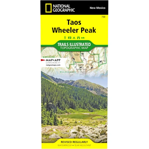
Home Shopping Other Taos, Wheeler Peak Map (National Geographic Trails Illustrated Map, 730)
By National Geographic Maps - Trails Illustrated (Author) Taos, Wheeler Peak Map (National Geographic Trails Illustrated Map, 730)

By National Geographic Maps - Trails Illustrated (Author) Taos, Wheeler Peak Map (National Geographic Trails Illustrated Map, 730)

( 120 reviews ) See Reviews (1Outlets)

In stock *In Stock - Subject to stock availability at point of fulfilment. In the event whereby the item is out of stock or unable to provide the service, 1Outlets will cancel the order and issue a Full refund in-store credit to you. SKU : 1348e2a385e4f60252d9f16f343db44d

USD10.22
  • Buy 2 for USD9.63 each and save 6%
  • Buy 10 for USD9.26 each and save 10%
Qty:

**Free Shipping Worldwide available - Shipping time may vary depending on the address.

**Circumstances Reroute - This is a time of great stress and uncertainty. We are actively validating, routing and re-routing orders with our overseas merchants, logistic partners and airlines. Deliveries and supply may expect delays.

**In Stock (Low Inventory Warning) - Subject to stock availability at point of fulfilment. In the event whereby the item is out of stock or unable to provide the service, 1Outlets will cancel the order and issue a Full refund in-store credit to you (See Refunds).

**Report or Request Removal  - Any copyrighted, DMCA, inappropriate, offensive, prohibited, potentially Illegal Listings (Submit doc here).

Details

Explore the Wild with National Geographic Trails Illustrated!

Embark on an epic adventure with the Taos, Wheeler Peak Map (National Geographic Trails Illustrated Map, 730)! This detailed and vibrant map is your key to unlocking the wonders of the Taos, Wheeler Peak region. With its rugged terrain and scenic trails, this map opens the door to exploration, letting you discover hidden treasures and create unforgettable memories. Prepare to traverse the wilderness, follow exciting pathways, and experience the beauty of nature firsthand.

Main Features

  • Contour Lines: See the mountains rise and valleys drop, understand the lay of the land, and plot your route with confidence.
    • Contour lines show the shape of the land, giving you a clear picture of hills, valleys, and slopes.
  • Waterproof and Tear-Resistant: Weather any storm; this map stands up to rain, sun, and the wear and tear of adventure.
    • This map is built to endure, letting you focus on the journey, not worrying about the elements.
  • Detailed Trail Information: Every path, marked and measured, every landmark, noted and named, so you never lose your way.
    • Find your way, no matter your adventure level, with trail details right at your fingertips.
  • Geographic Coordinates: Precise location pinpointing, giving you the power to find yourself anywhere, anytime.
    • Use coordinates to sync with your GPS, offering you the power of knowing your location in the wilderness.
  • Accurate Topography: Discover the region’s peaks, valleys, and forests with a clear and accurate rendering.
    • Accurate details let you truly experience the grandeur of the landscape.

Benefits

  • Boost Exploration: Unlock access to remote and beautiful areas.
    • Explore further; venture beyond the familiar and discover extraordinary landscapes.
  • Enhance Safety: Navigate with precision and confidence.
    • Reduce risk and explore safely, armed with accurate information.
  • Foster Independence: Inspire self-reliance and the joy of discovery.
    • Embrace the thrill of self-guided journeys and the satisfaction of finding your way.
  • Improve Planning: Design unforgettable adventures.
    • Plan routes, select campsites, and map your exploration journey, all with the power of this guide.
  • Create Memories: Craft experiences that will last a lifetime.
    • Capture moments, explore the trails, and build memories while experiencing the beauty of the outdoors.

Unique Selling Points / Competitive Advantages

  • Trusted Brand: National Geographic’s reputation for accuracy and quality.
    • Benefit from the backing of a brand that has been creating exceptional maps for years, known for its commitment to exploration and geographic data.
  • Durability: Built to withstand the rigors of the outdoors.
    • This map endures the elements, ensuring it's ready for any adventure.
  • Detailed Information: More comprehensive than the competition.
    • The map is filled with valuable data, ensuring you have everything you need for your adventure.
  • User-Friendly Design: Easy to read and understand.
    • Designed for everyone, ensuring an effortless, pleasurable planning experience.
  • Focus on the Region: Provides a specialized focus for a particular area.
    • Benefit from local expertise and focus, with details of a specific, treasured place.

Usage Scenarios

  • Family Hiking Trips: Guide the family on an exciting journey.
    • This map will help you navigate the trails safely and create lasting memories.
  • Solo Exploration: Discover the wilderness with confidence.
    • Travel with confidence knowing you have a map you can depend on.
  • Camping Adventures: Find the perfect campsite and plan your route.
    • Find the perfect spots to set up camp and explore your surroundings.
  • Educational Expeditions: Learn about the local geography.
    • Make your excursions a chance to learn about geography and appreciate the natural world.
  • Outdoor Activities: Perfect for biking, rock climbing, and other adventures.
    • Use this map to help you get the most out of your journeys.

Customer Reviews / Testimonials

  • "This map saved our trip! We navigated through challenging trails, and the details were perfect. Highly recommend it!" - Sofia, Italy, 2022
  • "The Taos, Wheeler Peak Map is a must-have for hikers. The waterproof feature is amazing! It’s the best outdoor companion." - Carlos, Mexico, 2023
  • "Detailed, accurate, and easy to read. A great investment for anyone planning a trip to the Wheeler Peak area." - Ethan, Canada, 2021
  • "I used this map for mountain biking. Accurate, durable, and packed with detail." - Anya, Australia, 2024
  • "As a beginner, I found it easy to follow. A great experience." - Liam, United Kingdom, 2020

Frequently Asked Questions

  • Q: Is the map easy to read?
    • A: Yes, the map features a clear and user-friendly design with easy-to-understand symbols and information.
  • Q: Can this map get wet?
    • A: Yes, the map is waterproof and tear-resistant, designed to withstand rain and moisture.
  • Q: Does the map include trail elevations?
    • A: Yes, the map provides detailed topographic information, including contour lines and elevation details for each trail.
  • Q: Is this map good for beginners?
    • A: Yes, its straightforward design makes it an excellent choice for beginner adventurers, along with more experienced hikers.
  • Q: How does this map help with planning?
    • A: This map is an amazing guide, letting you pinpoint the best route, and the terrain to enhance all of your plans.

BUY NOW

Answer the call of adventure and let National Geographic guide you! So grab your Taos, Wheeler Peak Map and start writing your own epic tales, for exploring the beautiful mountains and valleys!

(Beta: User Generated 2024.0007)
Specification
Terms & Warning